


Dist.4 Tylertown, Walthall County, Mississippi
About
Outline

Summary
| Unique Area Identifier | 606849 |
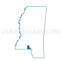
| Name | Dist.4 Tylertown |
| County | Walthall County |
| State | Mississippi |
| Area (square miles) | 13.55 |
| Land Area (square miles) | 13.54 |
| Water Area (square miles) | 0.02 |
| % of Land Area | 99.88 |
| % of Water Area | 0.12 |
| Latitude of the Internal Point | 31.16509820 |
| Longtitude of the Internal Point | -90.15046340 |
Maps


Graphs
Select a template below for downloading or customizing gragh for Dist.4 Tylertown, Walthall County, Mississippi


Neighbors
Neighoring Voting District (by Name) Neighboring Voting District on the Map
- Dinan Voting District, Walthall County, MS
- Dist.3 Tylertown, Walthall County, MS
- East Tylertown Voting District, Walthall County, MS
- North Knoxo Voting District, Walthall County, MS
- Saint Paul Voting District, Walthall County, MS
- Varnell Voting District, Walthall County, MS
- West Tylertown Voting District, Walthall County, MS
Top 10 Neighboring County Subdivision (by Population) Neighboring County Subdivision on the Map
- District 5, Walthall County, MS (3,304)
- District 4, Walthall County, MS (3,259)
- District 2, Walthall County, MS (2,986)
- District 3, Walthall County, MS (2,739)